Day Two -- We left Laramie on a route suggested by our buddy Dave, who had "flown the route" on his BMW Motorcycle late one evening looking for a campsite, and allowed as how it was a "must see."
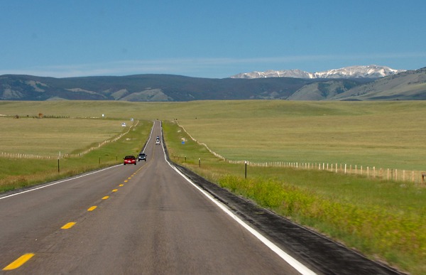
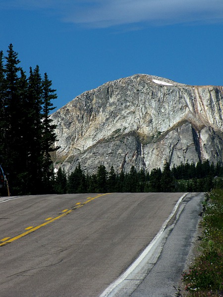
Snowy Mountains: We headed west on WY HWY 130 out of Laramie toward the Snowy Mountains, so-called because even when there's no snow on them, the white quartzite up top glistens like snow in the summer sun.
This route crosses the second highest highway pass in Wyoming and winds through a glacier-carved landscape with many alpine lakes and spectacular scenery.
Medicine Bow Range Geology: The Snowy Mountains are the high, rugged crest of the Medicine Bow Range. The highest peak is Medicine Bow Peak at 12,013 feet. The high point of the drive -- Medicine Bow Observation Point -- is 10,847 feet.
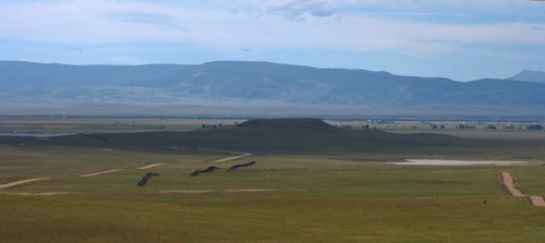 Big Hollow Basin, west of the airport and south of WY HWY 130, was probably formed by wind deflation. During the ice age, glaciers flowed down the mountains into the Laramie basin at Centennial to the west. Howling winds coming off the glacial ice scoured out the Hollow. No streams flow through the Hollow, an important clue in the geologic story.
 During Pleistocene times, streams carried quartzite gravels into the Basin. These gravels overlaid the Cretaceous marine black shales on the Basin floor.

Laramie Valley Looking South from WY HWY 130

Laramie Valley Looking Toward Snowy Mountains

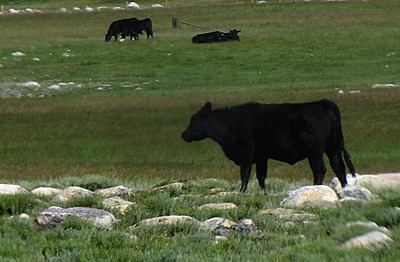
Cow on the Rocks in the Centennial Valley WY
Centennial Valley: We drove around the end of Sheep Mountain into the Centennial Valley -- which was a dad-gummed hardscrabble place to farm and ranch. Cows ate grass from among rubble piles of small boulders. The Centennial Valley is wide and colorful --some of that color due to pine beetles, of course, but enjoyable anyway.
 The town of Centennial sits squeezed between the Valley of Small Boulders and the main front of the Medicine Bow Mountains at an altitude of 8,000 feet. In 1875, prospectors discovered gold here, and Centennial was born, named for the US centennial. After weathering the usual boom-and-bust cycles of a mining economy, Centennial settled into a quiet existence as an agricultural and tourist town.
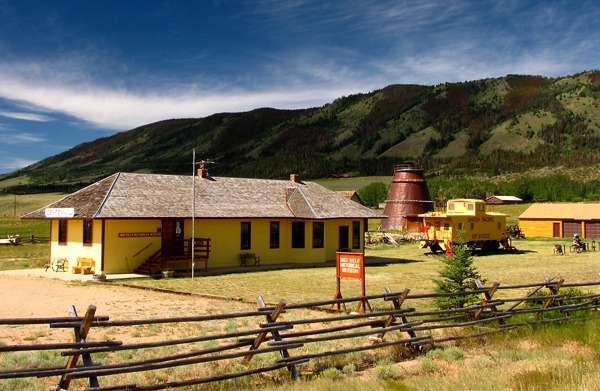
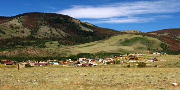 Not a whole lot to the town now -- some touristy spots, a bar or two, the usual suspect businesses for a small Wyoming town. But there was an interesting looking museum at the edge of town with a Union Pacific Railroad caboose in the front yard -- closed, unfortunately when we were there.
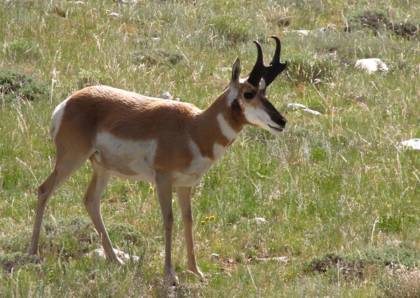
 Medicine Bow National Forest: As we continued west, a small group of pronghorns was grazing near the road, seemingly undisturbed by our passing.
 It's a pretty steep pull up out of Centennial; we stopped at the Medicine Bow National Forest visitor center about a mile and a half from town.

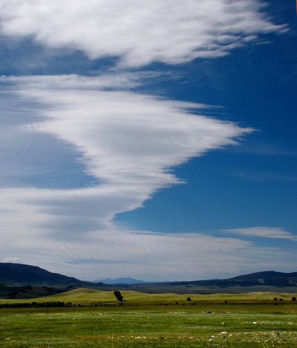
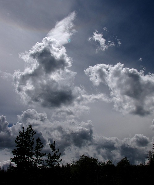
Cloudscape over Centennial Valley WY

Centennial WY

Centennial WY Museum
 Buck Outside Centennial WY&)
Pronghorn (Antilocapra americana) Buck Outside Centennial WY
Leesha visits the Forest Service: Leesha immediately hopped out of the car and started exploring. She sniffed the outhouse, the sidewalks, the access ramp, and the forest floor. She liked this spot! Then she headed for the Info Center door, determined to visit it for herself.
I was inside chatting with the ranger, and Leesha appeared at the door. Louise picked her up, and the ranger said "Come on in!" Leesha wiggled to express her wish to get down, and the ranger gave her the ok. Off went kitty -- over the ranger's desk, after stopping for a pet or two, and into the back room to look for mice. The ranger allowed that there were probably a few! The Center is closed in the winter, so there's ample opportunity for critters to take up residence. Leesha prowled and sniffed until it was time to head out. She let out a loud meow of protest when Louise picked her up -- she wasn't done sniffing!
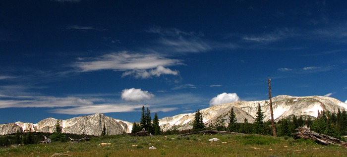
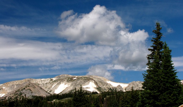
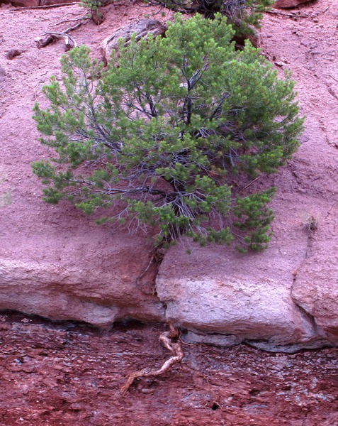
Headed to Timber Line: WY HWY 130 climbed steadily into the mountains, following the North Fork of the Little Laramie river for a mile or so. The forests were Engelmann spruce, aspen, subalpine fir, and lodgepole pine. At 10,000 feet we approached timberline; the trees were small and wind-shaped. Up here, extreme cold, high wind, and deep snows make it impossible for trees to grow. We were almost to the alpine tundra region, and rocky peaks dominated the view to the north.
 There are many Forest Service spur roads that allow access and exploration in this beautiful area. The scenery and the flowers, even for this late in the year, were amazing. We wandered on a Forest Service Road just before Libby Flats.
 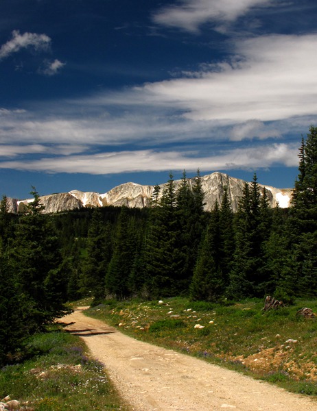 Leesha and Louise commenced hiking the road and exploring the meadows. My camera and I recorded the lovely meadow of alpine wildflowers. Up this high, flowers bloom when the weather is right -- often all at once in mid-summer.

Crest of the Snowy Mountains WY

WY HWY 130 to the Crest of the Snowy Mountains WY, Snowy Range Scenic Byway

Forest Service Road to Explore
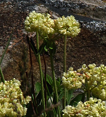
 and Granite&)
Buckwheat (Eriogonum speciosus) and Granite
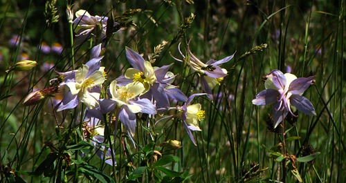
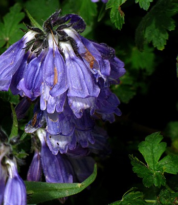
 Near the Crest&)
Blue Columbine (Aquilegia coerulea) Near the Crest
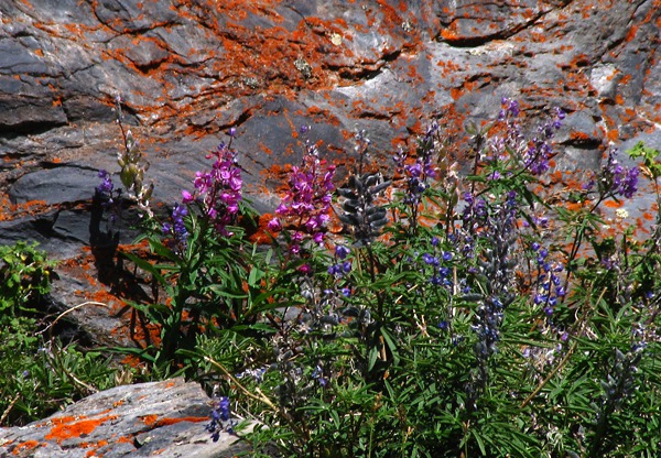
, Beard tongue (Penstemon), and Lichen Rock&)
Silvery Lupine (Lupinus argenteus), Beard tongue (Penstemon), and Lichen Rock
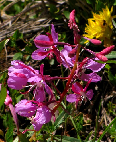
 and False Dandelion (Agoseris glauca)&)
Fireweed (Chamaenerion angustifolium) and False Dandelion (Agoseris glauca)
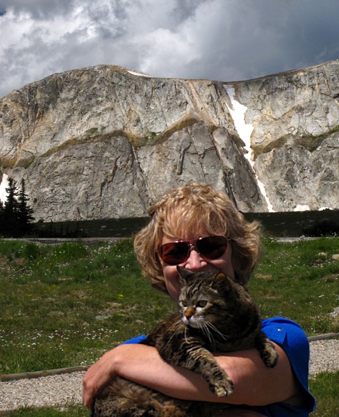
Leesha on Top of the World: The high granite ridges were a series of sculptural works interwoven with an array of cumulus that were springing up everywhere.
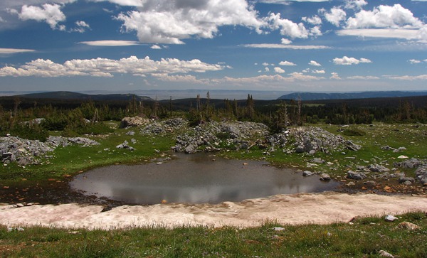
 We continued driving to the overlook at the top of the pass, where a huge alpine meadow stretched out across the plateau, again with a carpet of wild flowers surrounded by spectacular peaks and ridges. Leesha and Louise hiked the overlook trail, kitty sniffing and marching and exploring. She seemed unfazed by the thin, high-altitude air or the cold wind. She was literally "on top of the world!" And Leesha loved the top of the world aspect of the plateau. She marched all the way to a vernal pond in a snowbank down over the edge of the near ridge. She had about a half hour walk around the area, mixing in and around the white pines and meadow flowers.

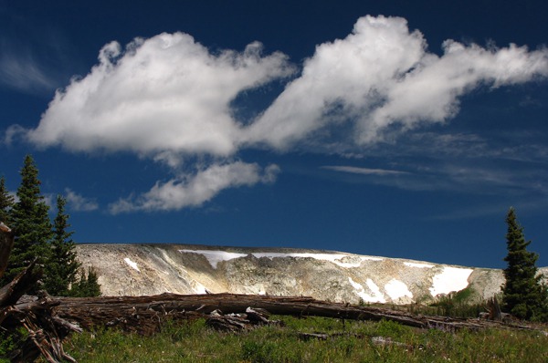
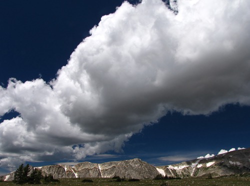
Snowy Mountains Crest Ridge with Cumulus Clouds

Long Ridge and Clouds
Photo Odyssey on Top of the World: Off I went to record flowers and critters.
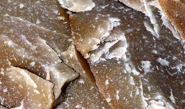
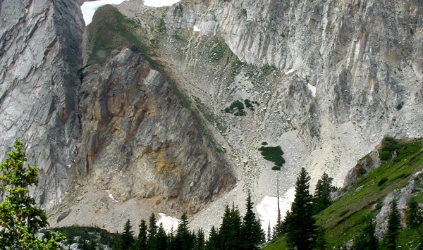
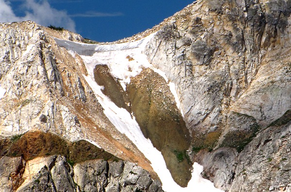
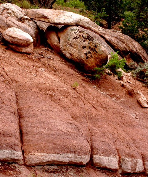
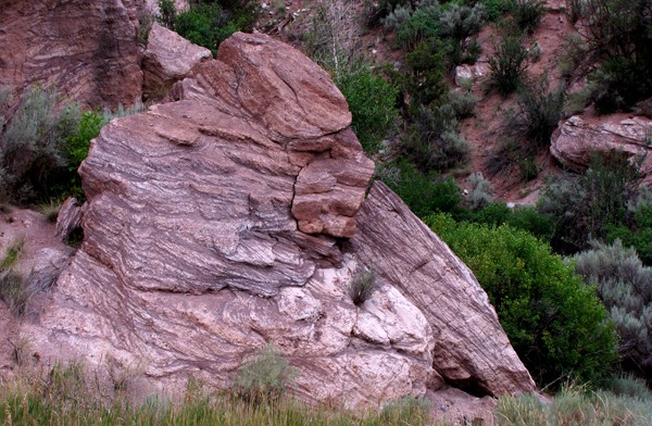
 Even the rocks on the plateau were worthy of note -- complicated and interesting. These are 1.7 billion-year-old metamorphosed sedimentary rocks: schist, quartzite, quartz-pebble conglomerate, meta-dolomite, and marble.
 Over the edge of the ridge was the small vernal pond left by the retreating snow. Louise and Furry walked down to the edge while I scouted more shots of the ridges behind us.
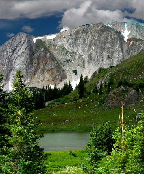
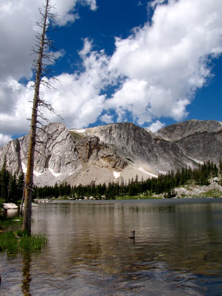
 Lakes, Lakes, Lakes: After this nice break on top of the pass, we started down the western slope. We had only gone about one switchback when we encountered a small lake shimmering at the base of the far ridge.
 The slopes were covered with twisted pines that had been tortured and sculptured by the climbing west wind.

 At the next turnoff, there was a sign with binoculars for wildlife watching; we looked up the draw near the sign but didn't see anything. Later at Mirror Lake nearby, a nice young couple from Michigan showed us a shot they took of two bull moose in the same meadow about fifteen minutes earlier. Where the heck were they when we went by?
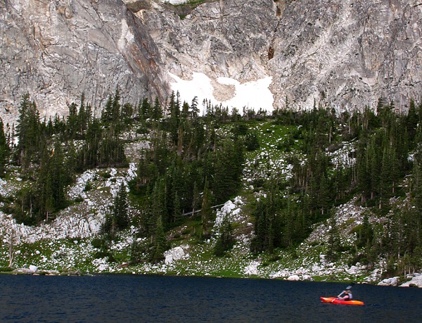
We pulled into the loop road at Mirror Lake, a stunning beauty.
At the next turnoff, there was a sign with binoculars for wildlife watching; we looked up the draw near the sign but didn't see anything. Later at Mirror Lake nearby, a nice young couple from Michigan showed us a shot they took of two bull moose in the same meadow about fifteen minutes earlier. Where the heck were they when we went by?
We pulled into the loop road at Mirror Lake, a stunning beauty.
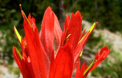
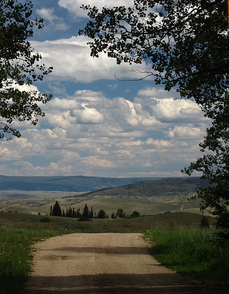
 Saratoga Valley and Encampment WY: We left the lakes and continued down slope headed west. The roadside ditches were a torrent of Indian Paintbrush (Wyoming's state flower) and other flowers.
 We dropped into the Saratoga Valley and turned onto WY HWY 230, headed toward the small town of Encampment. The valley is a narrow trough carved by the North Platte River between the Medicine Bow and Sierra Madre mountains. Encampment was the product of copper mining in the Sierra Madres. From 1899 to 1908, 24,000 pounds of copper came out of the Ferris-Haggarty mine. The ore was transported on a 16-mile long aerial tramway to Encampment's smelter.
Our idea was to go through Encampment, find a forest road made of dirt, and follow it into Steamboat Springs CO. It would be about sixty miles of gravel, and a trip our buddy Dave had pioneered for us.
We dropped into the Saratoga Valley and turned onto WY HWY 230, headed toward the small town of Encampment. The valley is a narrow trough carved by the North Platte River between the Medicine Bow and Sierra Madre mountains. Encampment was the product of copper mining in the Sierra Madres. From 1899 to 1908, 24,000 pounds of copper came out of the Ferris-Haggarty mine. The ore was transported on a 16-mile long aerial tramway to Encampment's smelter.
Our idea was to go through Encampment, find a forest road made of dirt, and follow it into Steamboat Springs CO. It would be about sixty miles of gravel, and a trip our buddy Dave had pioneered for us.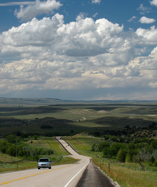 We drove in and through Encampment, stopping for gas at THE gas station and general store.
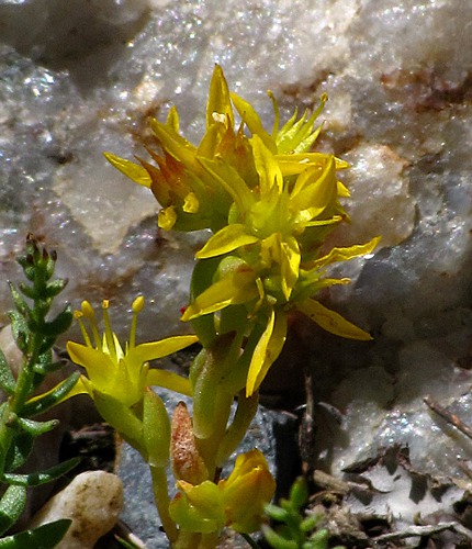
 in Front of Quartz&)
Wormleaf Stonecrop (Sedum stenopetalum) in Front of Quartz
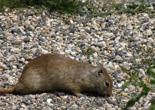
 on the Path&)
Wyoming Ground Squirrel (Urocitellus elegans) on the Path
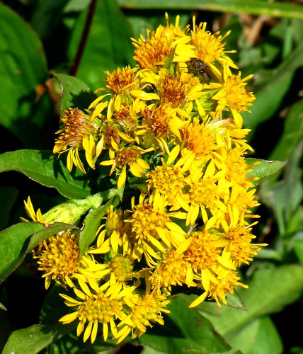
 with Fly&)
Goldenrod (Solidago) with Fly

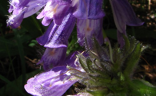
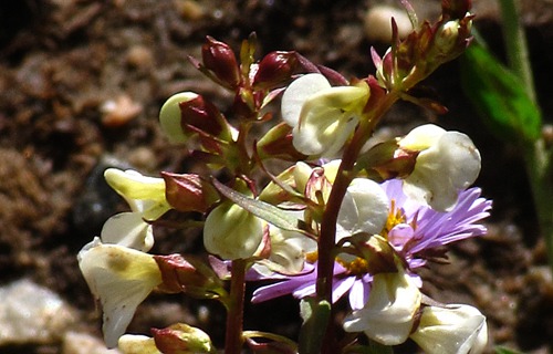
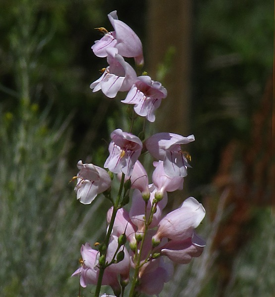
Penstemon
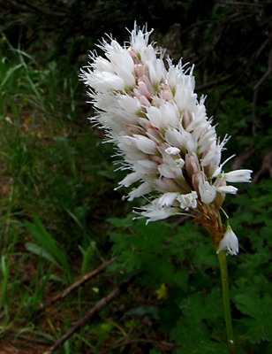
&)
American Bistort (Bistorta bistortoides)
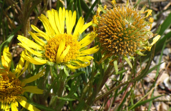
 on Plateau&)
Old-Man-of-the-Mountain (Tetraneuris grandiflora) on Plateau

Penstomon Cluster
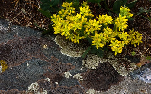
 and Lichen Rock&)
Wormleaf stonecrop (Sedum stenopetalum) and Lichen Rock
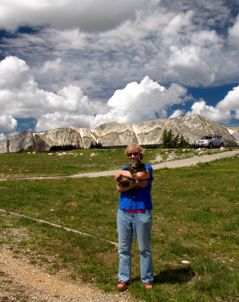
 at the Snowy Range Observation Point.&)
Louise and Leesha (aka Furry Purry) at the Snowy Range Observation Point.

Louise and Furry Purry at Libby Flats
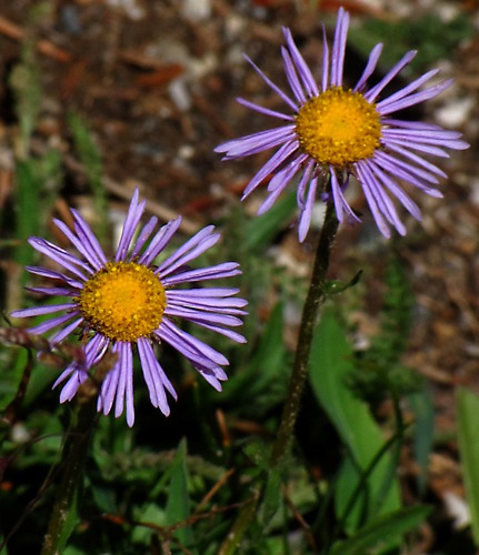
&)
Fleabane (Erigeron)
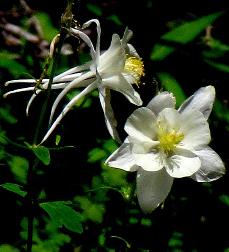
&)
Faded Yellow Columbine (Aquilegia flavescens)

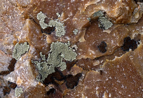
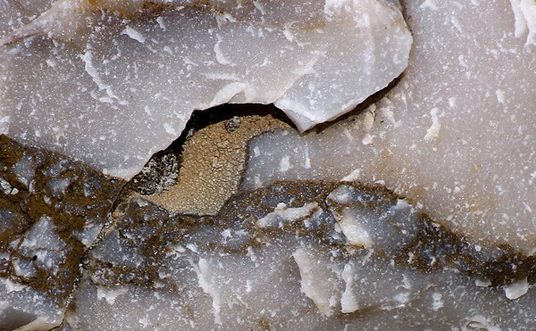
Marble Pattern

Marble Pattern with Lichen

Marble Puzzle

Vernal Pond with Residual Snowbank

Snowy Mountains Crest with Streaming Cumulus Clouds

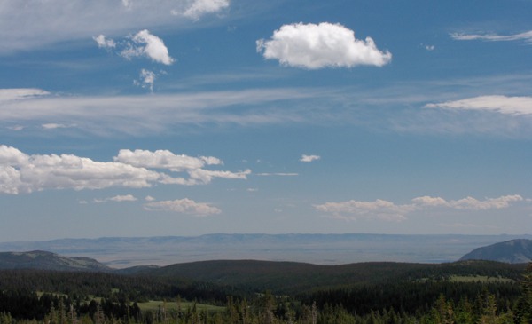
Looking Back Toward Laramie WY

Bellamy Lake Just West of Snowy Mountains Observation Point

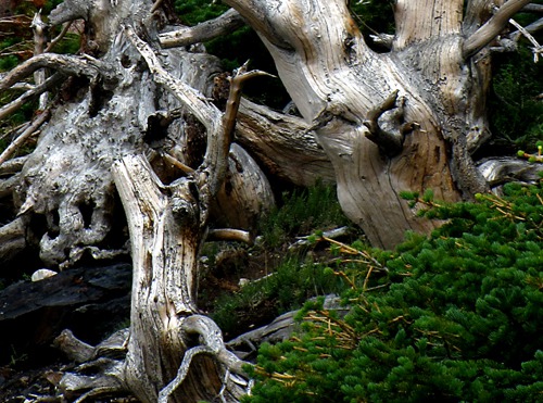
Pine Sculpture Cluster

Alpine Stream

Ridge Above Mirror Lake

Mirror Lake with Dead Tree and Ridge

Red Kayak on Mirror Lake

Snow-Packed Crevice at Mirror Lake
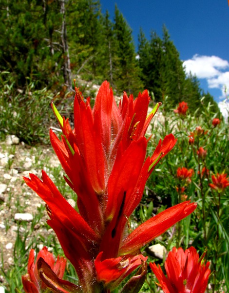
 on West Slope of the Snowy Mountains&)
Paintbrush (Castilleja linariaefolia) on West Slope of the Snowy Mountains
 on West Slope of the Snowy Mountains&)
Paintbrush (Castilleja linariaefolia) on West Slope of the Snowy Mountains

White Flowers on West Slope
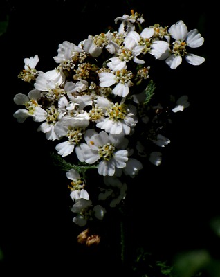
 &)
Yarrow (Achillea millefolium)
&)
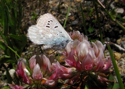
Pine White Butterfly on Clover (Trifolium)

Off the West Slope toward Encampment WY
Pine Beetles in Colorado: Then we headed west to find the end of the dirt road Dave had recommended. When we got to the turnoff, which was a little unclear as to which road it actually was, we found a Forest Service sign saying the road was closed for bug-killed timber removal at a point some fifteen miles down the road. There was conflicting information on the sign about just when that was supposed to happen. So we drove into a campground near the turnoff in hope of finding a local with "local knowledge" who could steer us straight.
We met a guy and his wife coming out of the campground who allowed as how it was always a little unclear as to when the road would be open, saying they had been getting conflicting information from the Forest Service themselves as to the closures. So we ate lunch while Furry patrolled around the picnic table. We looked back at Encampment Valley, and we weighed the risk of striking out blind.
 The pine beetles had hit that area hard. Most of the trees in the campground had been removed, and the few remaining were brown as shoe leather. This was the hardest hit area we've ever seen. Virtually the entire forest was gone. Too many trees, too little fire, too much drought -- and there you have it.
 Change of Plans: Deciding discretion was the better part of a long back-track if the dirt road was closed, we headed back into Encampment and WY HWY 230, the alternate, paved option toward Steamboat.
 We drove back through town, stopped again at the gas station for spud chips to keep us bolstered, and the guy at the cash register told us the same thing the campers had -- that the road had been open and closed off and on, and there was really no way of knowing which it would be on any given day. So we resigned ourselves to pavement. Not far out of town, there was an eagle (one of our signs we're on the right track) sitting on a telephone pole downhill from where we were able to pull over.

Encampment WY Valley

Penstemon in Campground Near Encampment WY on Blacktail Mountain Road

Clouds over Campground Near Encampment WY

Pine Beetle Brownout at Campground Near Encampment WY

Road Back out of Campground

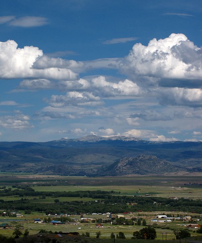
Encampment Valley Looking East Toward the Snowys
On to Steamboat Springs CO: WY HWY 230, soon to be CO HWY 125, follows the North Platte River as it flows north to Casper WY.
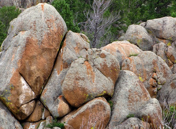
 Still in Wyoming, we entered a canyon of huge boulder piles reminiscent of the ones that line Homestake Pass between Whitehall and Butte in Montana. We are always intrigued by the varied geology we encounter in our travels. Louise usually has the "Roadside Geology of ..." book for the state we're in, open in her lap.
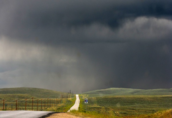
 Soon we hit rolling hill country again just as a wicked thunderstorm unleashed a load in the road ahead. Our route took us on CO HWY 125 to Walden, CO HWY 14 south and west over Muddy Pass and Rabbit Ears Pass, and CO HWY 131 out of Steamboat Springs. Too bad the misty rain put the kibosh on picture taking through this spectacular country.
We drove around Steamboat without stopping -- it was raining, and the valley had gone from a quaint ski valley the last time either of us had been there years ago to a prototypical "Third-Home Gated Community" landscape. "Seen it before, no need to stop folks, move along to something interesting." It is heartbreaking to see the casual destruction of so much wildlife habitat.
Soon we hit rolling hill country again just as a wicked thunderstorm unleashed a load in the road ahead. Our route took us on CO HWY 125 to Walden, CO HWY 14 south and west over Muddy Pass and Rabbit Ears Pass, and CO HWY 131 out of Steamboat Springs. Too bad the misty rain put the kibosh on picture taking through this spectacular country.
We drove around Steamboat without stopping -- it was raining, and the valley had gone from a quaint ski valley the last time either of us had been there years ago to a prototypical "Third-Home Gated Community" landscape. "Seen it before, no need to stop folks, move along to something interesting." It is heartbreaking to see the casual destruction of so much wildlife habitat.
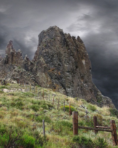
 More Fascinating Geology: It was still raining off and on when we came to an area of amazing volcanic formations just outside Yampa CO. All around us were lava tubes that had been frozen still as the land around them eroded away, leaving dozens of upthrust columns silhouetted against the gray skies. We saw a small dirt side road that we thought was a county road, but ended up being a ranch lane. But on that road was an amazing formation that we thought from the map might have been Devil's Grave Mesa. It certainly deserved such a name!
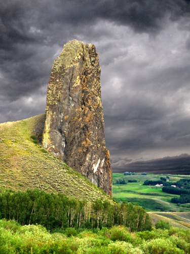
 As we drove back to pavement and continued on, we saw Finger Rock, a huge column standing roadside. The rock figured in the mythology of the Ute Indians who once called the valley home. Perhaps the warrior wrestling the god Manitou lost his finger or perhaps he himself was turned to stone for defying the god. The volcanic tube jutted 350 feet above the valley floor; you could see if for miles.
We were going south along the Yampa River here as it flowed north to Steamboat Springs where it turns west to the Green River in Utah. Amazing how the mountains turn these rivers in incongruous directions! The Yampa is only twenty miles from the Colorado River, which is flowing west to the Green River. But the Yampa has to flow north because of the Gore Range.
As we drove back to pavement and continued on, we saw Finger Rock, a huge column standing roadside. The rock figured in the mythology of the Ute Indians who once called the valley home. Perhaps the warrior wrestling the god Manitou lost his finger or perhaps he himself was turned to stone for defying the god. The volcanic tube jutted 350 feet above the valley floor; you could see if for miles.
We were going south along the Yampa River here as it flowed north to Steamboat Springs where it turns west to the Green River in Utah. Amazing how the mountains turn these rivers in incongruous directions! The Yampa is only twenty miles from the Colorado River, which is flowing west to the Green River. But the Yampa has to flow north because of the Gore Range.
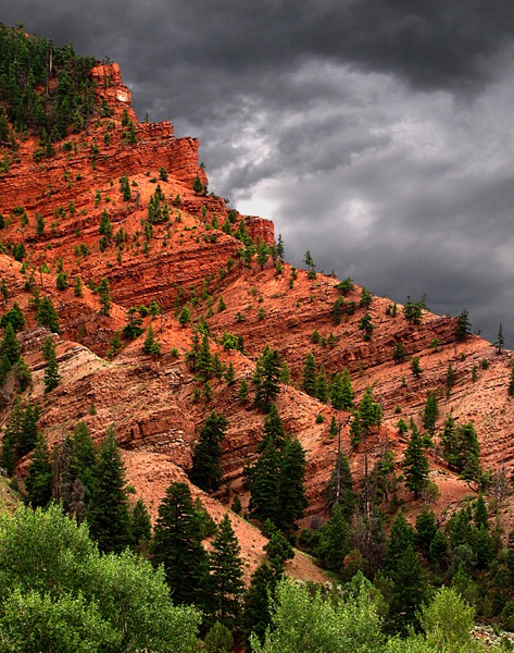
 CO HWY 131, a narrow two-lane paved road that would eventually take us to Eagle, wound through a series of almost southwestern-flavored canyons lined with red side walls and cliffs. It was nearly dark and raining, or it would have been a great spot to explore photographically -- for hours.
 At McCoy, we started following the Colorado River; we crossed at State Bridge. Finally we hit the Eagle River and I 70 at Wolcott. We stayed on old US HWY 6 into Eagle; the red cliffs outside Eagle were amazing, even in the fading light.
 on Phone Pole Near Encampment WY &)
Bald Eagle (Haliaeetus leucocephalus) on Phone Pole Near Encampment WY

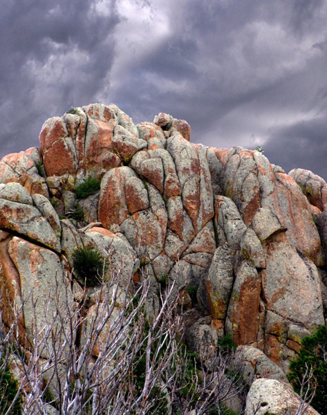
Roadside Rock Stack Along WY HWY 230 in North Gate Canyon of the North Platte River

Roadside Rock Stack With Threatening Sky Roadside Rock Stack Along WY HWY 230 in North Gate Canyon of the North Platte R

Rain Descends on CO HWY 14

Lava Plug Formation at the End of Devil's Grave Mesa in Yampa CO

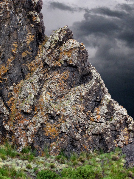
Finger Rock Lava Plug Near Yampa CO

Bottom of Finger Rock Lava Plug Near Yampa CO

Boulders and Red Sandstone Along CO HWY 131

Boulders and Red Sandstone Along CO HWY 131

Tree Beats Rock in Red Sandstone Along CO HWY 131

Canyon Wall Along the Eagle River Outside Eagle CO
At Rest in Eagle CO: We crossed the bridge over the Eagle River off US HWY 6, and pulled into the Eagle Lodge motel, which proved to be a great spot to stay. And we had uncharacteristically gotten into the motel in time to take advantage of the amenities.
Leesha, after a nice supper of her special rabbit wet kitty food went sound asleep on the bed. She'd walked a long ways for a little cat, and at the highest altitude she'd ever experienced! Louise headed to the gym and the elliptical, and I headed to the hot tub.
At the hot tub, there was a man with two young boys, and they were hanging out like guests, and we started talking. As it turned out, they had lost everything in a house fire started by one of the very sweet little guys playing with a cigarette lighter -- a fire that had blown up so fast it had barely given them time to escape. So they were staying at the hotel until they could get their house repaired.
The father had lost all his tools, his confirmation clothes he'd been saving for the boys, and was also recently divorced. Man, that was some tough sledding. But talk about attitude -- they were all determined to make it into the best experience they could. Inspiring and sad at the same time.
A woman in the hot tub with her daughter told me that her daughter was headed for college after the summer was over, and that the only thing she wanted for high-school graduation was a "girls' weekend" with her mom.
So they had driven up from Denver to spend a few days in Eagle to do some hiking and just hanging out together. So all in all, the hot tub hour was one of those "faith in humanity" experiences. Nice way to go to sleep.
Brian and Louise with pictures by Brian. Text and Photos copyright Goin Mobyle LLC, 2010
We use a variety of resources when we travel; here are the ones we used a lot on this trip and all on this day. Benchmark Press: Colorado Road & Recreation Atlas.
Benchmark Press: Wyoming Road & Recreation Atlas.
Chronic, Halka and Felice Williams: Roadside Geology of Colorado.
Gregory, Lee: Colorado Scenic Guide: Northern Region.
Gregory, Lee: Colorado Scenic Guide: Southern Region.
Lageson, David and Darwin Spearing: Roadside Geology of Wyoming.
Moulton, Candy: Roadside History of Wyoming.
Parent, Laurence: Scenic Driving Wyoming.
Pitcher, Don: Wyoming Handbook.
Schiemann, Donald: Wildflowers of Montana.